Guess what? I’m back on that 40k Mapping thing again!
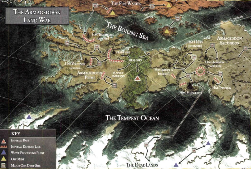
Behold Armageddon, one of the most fought over planets in the Imperium, with a Chaos invasion led by a Daemon Primarch, two Ork invasions led by Margaret Thatcher and the current general insanity caused by GW’s decision to move the plot forward under its belt.

It’s a pretty nice map, however ever since its publication everyone at GW has completely forgotten how to read it.
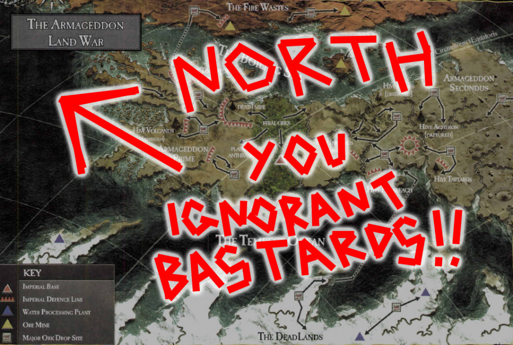
Look at those lines. That’s right, the curved ones. They indicate that we’re not looking at a flat map, we’re looking at some kind of globular projection. Furthermore notice that the lines are slanted – that means that we’re not looking at the map from a cardinal direction (north, south, east or west), but at an angle. And hey! Look in the upper right hand corner! One of the lines is marked as the equator! This tells us that north is to the upper left!

Unfortunately this is something that has escaped the notice of GW’s writers and artists who have consistently read it as a flattened, north oriented map, even publishing redraws of it with an upwards pointing compass rose slapped on top – most notably in the recent reprint of Gavin Thorpe’s Annihilation Squad (a damn good read actually, despite the compass directions being all screwy BECAUSE NO ONE AT GW CAN READ A GODDAMN MAP!).
Perhaps the silliest aspect of this are the planet’s famous equatorial jungles. If we look at the map above we can see that this name makes sense – they sit right across the planet’s equator. If we go by the later maps however they’re just randomly plonked running north to south, giving one the impression that whatever Ordo Cartographica scribe first charted the planet was hitting the amasec really hard.
So, what to do about this all this malarkey (apart from making a ranting blog post that no one else will ever care about)? Why, redraft the map of course!
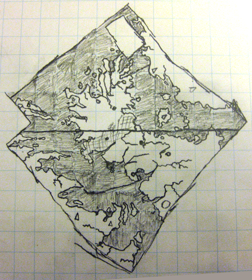
Now, this is a bit easier said than done. The globular projection adds all kinds of distortions and while I am sure there is software out there that can correct them in the twinkling of a nurgling’s eye I don’t have access to them. So I decided to go old school and resort to paper and pencil.
Step one was to make the map grid a bit denser. I did this by tracing the existing grid in Inkscape and then running additional lines between each of them, splitting each of the existing map squares into four. Step two was to grab a piece of graph paper and sketch in the details of each square…

So there we have it! That’s what a flattened out, north oriented Armageddon map really looks like! Armageddon Primus is actually north of Armageddon Secundus and the entire continent is stumpier than the angled view suggests
So, I now expect GW to start using this corrected version immediately! ;D
EDIT: Yes, it is rather strange that the continent to the west (the Dead Lands) is completely frozen over while the central continent (at the same latitudes) isn’t. There’s a clue to this in that the eastern continent (the Fire Wastes) appear to be barren desert. This would suggest that Armageddon has a pretty severe axial tilt combined with some rather weird orbital characteristics – which given its ancient history (no spoilers, but go read The Beast Arises…) is actually rather plausible.

